A simple topographical Europe Map
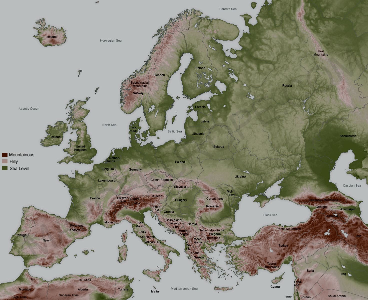
Here we present a simple topographical map of Europe. The darker reds and browns are the higher and mountainous regions. The lighter brown and pink regions are the hilly regions and foothills of the mountains. The light green regions are the plains areas and the dark green areas are the sea level or close to sea level areas.
As you can see as you head East, Europe tends to get flatter and lower. The only exception to this are the Ural mountains, which blip up a little as we head into Russia proper. The highest regions are the Alps and the Pyrenese mountains. Although there are some regions in Bosnia-Herzegovina and in Bulgaria that are quite mountainous also.