Map of Wales
We have finally added a political map of Wales. How can we be a site that claims to know things about the map of Europe and not have a map of Wales? Well finally we have rectified that situation.
Wales is one of the countries that make up the United Kingdom. Which of course is situated in Western Europe.
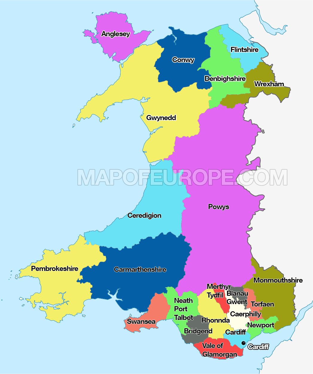
The 8 preserved counties of Wales were created in 1972 and the 22 single-tier principal areas were created in 1996.
| Counties | Principal Areas | Area | Population |
| Clwyd | Conwy Denbighshire Flintshire Wrexham |
2,910 | 491,100 |
| Dyfed | Carmarthenshire Ceredigion Pembrokeshire |
5,780 | 375,200 |
| Gwent | Blaenau Gwent Caerphilly Monmouthshire Newport Torfaen |
1,553 | 560,500 |
| Gwynedd | Gwynedd Isle of Anglesey |
3,262 | 187,400 |
| Mid Glamorgan | Bridgend Merthyr Tydfil Rhondda Cynon Taf |
781 | 423,200 |
| Powys | Powys | 5,196 | 132,000 |
| South Glamorgan | Cardiff Vale of Glamorgan |
475 | 445,000 |
| West Glamorgan | Neath Port Talbot Swansea |
820 | 365,500 |
In the near future we will be bringing maps of all the counties of Wales and all the Principal areas.